Chomolhari – Laya Gasa Trek
Map
Watch: Bhutan highlights
This trek offers you a diverse variety of Bhutanese landscapes and culture and is without doubt one of the most beautiful and unspoiled trekking areas in the entire Himalayas.
 The trek begins beyond Drugyel Dzong passing through interesting villages, scattered hamlets and farmland. Vegetation zones differ from richly forested valleys to high alpine pastureland where Yak herders graze their animals. Majestic views of Mt. Masagang near the Tibet border. Trout fishing in a sky blue lake with magnificent views of three majestic peaks is an activity that can be done on a rest day. You will also encounter rare species like the blue sheep, and with any luck, possibly even the snow leopard!
The unique culture of the friendly Layap people is fascinating to experience and gives one a sense of being in a truly remote corner of our world.
Kevin Grange has written a wonderful book chronicling this trip which is the first part of the Snowman Trek:
http://www.youtube.com/watch?v=1GMD71fcwIA
Detailed Itinerary
ARRIVE PARO BHUTAN BY DRUK AIR
Arrive Paro by Druk Air Airbus 319 jet, the national carrier. The flight offers you beautiful views of mountains on your approach. On arrival and after visa formalities you will be received by our representatives and transferred to your very comfortable hotel.
In the afternoon you will have the opportunity to explore Paro town a little and visit Paro Dzong. A Dzong is part fortress, part castle, part monastery and part administration building. Paro Dzong is one of Bhutan’s most impressive and well-known dzongs, and the finest example of Bhutanese architecture we’ll see. The inward-sloping walls form a massive structure that towers over the town and is visible as a great white monolith from vantage points throughout the valley. Paro is at 2280 metres (7500 ft).
1
DAY HIKE TO TAKTSANG MONASTERY ("TIGER'S NEST")
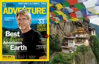
Day hike to Taktsang monastery, the famous “Tiger’s Nest”. Horses can be arranged for an extra $5 usd. The hike which is all up hill takes about 2 /3 hours through villages and pine forests. The monastery which clings to a huge granite cliff 800 meters above the Paro valley was devastated by fire in 1998 but the Royal Government has taken immediate steps to restore the monastery to its original structure. It is believed that the Buddhist saint Padmasambhava came in the 7th century on a flying tigress and meditated in a cave for 3 months. The demons were subdued who were trying to stop the spread of Buddhism and converted the Paro valley to Buddhism. During the end of the 17 century, a monastery was built on the spot where the saint meditated and it is a pilgrimage site for every Bhutanese to visit once in their life time. Stroll back to hotel.
2
DRIVE TO ARMY CAMP, AND TREK TO PINE CAMP
Drive to Drugyel Dzong where the trek used to begin, and continue on up the extended rough road beyond Army Camp to the bridge at Shana. The trek begins here so we're not walking up the new road that is always in flux, and then continues upstream along the Paro Chuu river valley through forest stopping briefly for a packed-lunch en route, gradually ascending to about 3000m/9850ft at Pine camp or a nearby campsite. From Pine Camp there is a local hike option to a nearby village with its community school and where we see excellent examples of typical Bhutanese farmhouses. This hike to the village is done when we make good time to the camp as road conditions are unpredictable. Walk is approximately 4 hours depending on road drop-off point.
3
TREK FROM PINE CAMP TO SOI THANGTHANGKHA
Pine Camp to Soi Thangthangkha. The trail again follows the Pachu river ascending through pine, oak and spruce forest. Picnic lunch will be served along the trail. The camp is at an altitude of 3,800 meters near a stone shelter. Walking time 7/8 hours.
4
TREK FROM THANGTHANGKHA TO JANGOTHANG
Soi to Jangothang. Climb slowly for a while till you reach an army camp. Then follow the river above tree line with stunning views of the surrounding peaks. Hot lunch will be served inside a Yak herders camp. A easy walk will reach you to Jangothang at an altitude of 4,050 meters. The view of Chomolhari (7,320 m) and Jichu Drake (6,900 m) is superb. Both the mountains are still virgin peaks. Walking time 4/5 hours.
5
REST DAY AT JANGOTHANG (CHOMOLHARI BASE CAMP)
Rest at Jangothang also known as Chomolhari Base Camp. Explore the surrounding areas like Tshophu lake, visit Yak herders or simply relax.
6
TREK FROM JANGOTHANG TO LINGSHI
Jangothang to Lingshi. The trail follows the stream for half an hour and crosses the bridge to the right side. Climb up the ridge and enjoy stunning views of Chomolhari, Jichu Drake and Tsherim Khang mountains. Then walk through the wide open valley sometimes coming across herds of blue sheep. The climb up to the Nyele la pass (4,800 m) is not too difficult and the view is breathtaking. After the pass it’s a gradual descent through the valley with beautiful views all around. Nearing the camp you will see the Lingshi Dzong perched atop a hill with commanding views of the valley. Arrive camp at (4,100 m) near a stone shelter. Walking time 6/7 hours.
7
TREK FROM LINGSHI TO CHEBISA
Today is an easier day after the rigours of yesterday as we climb past Lingshi dzong, perched on the hill top with a commanding view of green hills, the winding river and magnificent peaks. It is a pleasant walk through villages and yak herder's camp. After lunch, a short walk will take you to Chebisa village. Camp by the side of the stream at an altitude of 3,850m. Walking time: 5/6 hours.
8
TREK FROM CHEBISA TO SHOMUTHANG
Today begins with a steep climb up a ridge to Gombu La pass at an altitude of 4,400m, taking nearly four hours. After the pass descend to a lunch stop, through rhododendron bushes. Afternoon continue along the up and down path, after crossing the stream, through rhododendron forests and yak herders camp. We may see herds of Blue Sheep near the pass.. Camp is at 4,220 m. Walking time 6/7 hours.
9
TREK FROM SHOMUTHANG TO ROBLUTHANG
The trek starts with a climb up to the Jhari La pass at an altitude of 4,700m. Then descend to Tsheri Jathang valley, the summer residence of the rare Himalayan Takin (national animal of Bhutan). From here we may have to cross the stream as the foot bridge is often washed away. After crossing the stream towards the left, the trail climbs to reach Robluthang camp at an altitude of 4,400m. Walking time 7/8 hours.The trek starts with a climb up to the Jhari La pass at an altitude of 4,700m. Then descend to Tsheri Jathang valley, the summer residence of the rare Himalayan Takin (national animal of Bhutan). From here we may have to cross the stream as the foot bridge is often washed away. After crossing the stream towards the left, the trail climbs to reach Robluthang camp at an altitude of 4,400m. Walking time 7/8 hours.
10
TREK FROM ROBLUTHANG TO LIMITHANG
It is a long climb up to Sinche La pass (5,000 m). The view of the mountains from the path is spectacular. After the pass the trail descends to Limithang, and is sometimes quite narrow so you may have to cross a stream again and get your feet wet! The last part of the trek is very interesting with a view of Mt. Gangchey Ta peak. The camp is at an altitude of 4,150m. Walking time 7/8 hours.
11
TREK FROM LIMITHANG TO LAYA
In the morning you wake up to a superb view of Gangchey Ta peak. The walk to Laya is very pleasant with incredible views. You will pass through dense forests, filled with moss and singing birds. Arrive at Laya village, the second highest settlement in the country, at an altitude of 3,840m. Walking time: 5/6 hours. Time may allow for our guide will take us to a local house where traditional Bhutanese hospitality is extended and a cup of tea and Chang (local drink) is always offered. The people in this village are culturally very interesting, especially the women who wear conical bamboo hats decorated with turquoise and silver ornaments. In the evening we have an opportunity to see some dancing and singing performed by local villagers around a campfire and to “sample” the local alcohol of Ara & Chang - if you are brave enough!
12
TREK FROM LAYA – KULU KHAR I 6-7 hours
The trail initially starts with an uphill climb until you enter the meadow. From here you gradually descend down to a small river with a view of Lungo village. Cross the Zamdochhu River and climb for 2 hours to reach Lungo Village. This village offers a stunning view of the surrounding landscape. From here you continue on a flat trail parallel to Zamdochhu River upstream. Along the course of the trail you will enjoy the magnificent view of Mt. Tsendagang on the right, and the stunning views of Mt. Masagang on the left.
13
TREK FROM KULU KHAR TO NULITHANG (4103m/6 km/3 hour and further optional day hike)
In term of distance to cover, today is relatively short, beginning with a hike a little further into the valley to reach the foot of the Masagang (7,194 m). A waterfall covers the steep stone walls and fills the air with the roar of thunder. The high meadows we pass through are very dry and serve the yak shepherds from Laya as winter pastures. Camp Nulithang (4.050 m) is opposite Masagang, 10 minutes after crossing the Nung Chi Tang River. We walk a bit longer along the river to another campsite, located next to a small stream, and that offers a better protection from the wind. Yaks graze on the slopes, and every now and then a shepherd camp is viewed on the way.
Optional hikes in the afternoon
For today, there are couple of excursion as possibilities. In all cases amidst breathtaking mountain vista.
Firstly, climb to “Chethola view point ” (5010 m) which accesses uninterrupted view of Mt Massaging near the Tibet border. It appears so close that it gives an impression that one can touch it by merely stretching one's hand. Note, the trail is steep and not proper and follows the same way down. It takes around 4 hours for round trip.
Secondly, this relatively less demanding to hike other hills. Starting from above Somji, ascend a hill ridge, and as we follow the trail Mt Masagang gradually opens to our view, further hike of 2 hours lead to Yak herder Camp, and from here it displays exotic views of Mt. Masagang, Tsenda Khang, Kang Bum and other peaks.
14
TREK FROM NULITHANG TO TAKSE MARKA (3480m/ 14 km/ 6 hours)
Today is relatively easy day hike in term of gradation without any noticeable switch backs. Before leaving you may visit beautiful alpine dale for the last time. Perhaps, taking a hour walk in the vicinity. After, descend leaving behind the great stunning Himalayan mountain descending to Takse Marka. We can see the trail where it leads to Lungo village to the right side. Camping in beautiful Takse Marka as it lies shadow side of mountain, so brace for the cold night.
15
TAKSE MARKA – GASA HOT SPRING
We trek for about 5 hours till the road head near Koina. We are met by our private vehicle at this point and we drive for 2 to 3 hours to Gasa hotspring. The road at present is a bit rough so guests should be prepared for some bumps along the ride. An optional visit to the Gasa Dzong which overlooks the valley. Guests can also soak (bring swimwear) in the hot springs which are known for their medicinal properties. Overnight in camp.
16
DRIVE TO PUNKHA (3 hours) PUNAKHA SIGHTSEEING AND OVERNIGHT IN HOTEL
The 3 hour drive to Punakha is through the Jigme Dorji Wangchuk National Park. The drive is through thick forests of beautiful trees alongside the gushing river side. It takes us past the picturesque village of Damji which is located halfway through the drive. Once in Punakha you have the option of a short hike through paddy fields and villages to the Khamsum Yuelley chorten before checking into the hotel. If this option is taken an earlier start from Gasa is a must, because it takes 1-2 hours to factor this in, and only only those who want really packed itineraries. It also has to be done in this sequence, as it lies close to where the Gasa road enters Punakha.
After check in at the hotel and lunch, we then set out for sightseeing of the Punakha Dzong which straddles an island between the male and female tributaries of the river . Timings when the monk body is in residence is 11 AM - 1 PM, and 3-5 PM. When the monk body is not in residence then the timing is 9 AM -5 PM with closure at lunch (1 - 2 PM).
Assuming we make good time, we can also take a short drive of 15-20 minutes to the Temple of the "Divine Madman" Chimi Lhakhang where people go to pray for progeny. Timings 9 AM - 5 PM with lunch between 1-2 PM. Chimi Lhakhang also known as the “Fertility Temple” originally built in 1499 on a short hill that had been blessed by rogue Buddhist leader Drupka Kunley, known as the "Divine Madman” who worked overtime to spread enlightenment through an active sex life. At Chimi Lhakhang the abundance of penises still adorn the walls of the nearby buildings, and wooden phalluses are still kept by monks, used to bless women that seek to be blessed with children. If we cannot make it to Chimi Lhakhang due to longer sightseeing time spent at the Dzong, we will do it en route to Thimphu the next day. Evening rest at hotel.
17
SIGHTSEEING OF THIMPHU AND OVERNIGHT IN HOTEL
Drive to Thimphu which is 2.5 hours away. En route stop for sightseeing and a cup of tea at Dochula pass. The 108 Druk Wangyel chortens are set against the backdrop of the majestic Himalayas and it is a popular stop for scenic views. We continue onwards to Thimphu. Lying at an elevation of 2320m above sea level the capital of Bhutan is a blend of the traditional and the modern. It is the only capital in the world without streetlights relying instead on the elegant gestures of a traffic policemen. Thimphu is filled with many sightseeing options like the Buddha statue, the Memorial Chorten, School of Arts and Crafts, Simply Bhutan, Changangkha Lhakhang etc. We will try accommodate guests interests subject to timings and availability of time. One also has the option of individual exploration in this bustling growing capital.
18
TRANSFER TO AIRPORT FOR DEPARTURE
One hour drive from Thimphu to Paro airport for departure in time for your onward destination.
19
PLEASE NOTE: On adventure trips of this type, local weather, politics, transport or a multitude of other factors beyond our control can result in a change of itinerary. It is, however, very unlikely that the itinerary would be substantially altered; if alterations are necessary the leader will decide what is the best alternative, taking into consideration the best interests of the whole group. Where a change does occur, we do everything we can to minimize its effect, but we cannot be responsible for the results of changes or delays.
Esther's pictures of this trek (in Oct):: Esther's Chomolhari - Laya - Gasa Photo Gallery
Steve's pictures of this trek (in May):: Steve's Chomolhari - Laya - Gasa Photo Gallery
Synopsis
Trip Grading:

Length: 19 days.
Max. Altitude: 4950m / 16,235ft
Begins/Ends in Paro, Bhutan.
Land Cost: $8150 USD (Based on 2 participants sharing. Limited space / Druk Air seats)
International Airfare: Apx. $1900 USD from most cities.
Sep 18 - Oct 06 '23
Sep 25 - Oct 13 '23
Oct 09 - Oct 27 '23
Oct 22 - Nov 09 '23
Mar 24 - Apr 11 '24
Apr 08 - Apr 26 '24
May 06 - May 24 '24
Sep 16 - Oct 04 '24
Oct 07 - Oct 25 '24
Oct 20 - Nov 07 '24
You can also contact Canadian Himalayan Expeditions directly for more information.
Synopsis
Trip Grading:
Length: 19 days.
Max. Altitude: 4950m / 16,235ft
Begins/Ends in Paro, Bhutan.
Land Cost: $8150 USD (Based on 2 participants sharing. Limited space / Druk Air seats)
International Airfare: Apx. $1900 USD from most cities.
Sep 18 - Oct 06 '23
Sep 25 - Oct 13 '23
Oct 09 - Oct 27 '23
Oct 22 - Nov 09 '23
Mar 24 - Apr 11 '24
Apr 08 - Apr 26 '24
May 06 - May 24 '24
Sep 16 - Oct 04 '24
Oct 07 - Oct 25 '24
Oct 20 - Nov 07 '24
You can also contact Canadian Himalayan Expeditions directly for more information.