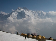
Kangchenjunga Base Camp
Map
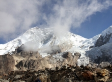
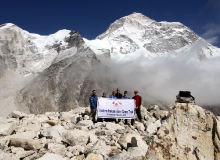
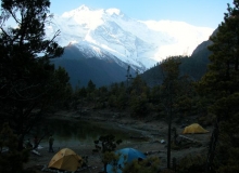
The main peak and its immediate satellites take the form of a giant cross which straddles the borders of three countries – Nepal, Tibet and the once independent kingdom but now Indian state of Sikkim. By virtue of the massif’s almost total isolation from any other mountain group, precise definition of its boundaries is quite unnecessary. Until 1849 Kangchenjunga was thought to be the world’s highest mountain, but today’s accepted height of 8,586m ranks it third, after Everest and K2.
 In addition to the main peak, four subsidiary summits exceed 8000m, the most important being Kangchenjunga West, also known as Yalung Kang (8,505m). Of some twenty peaks exceeding 7,000m, the highest are Kambachen (7,903m), Jannu (7,710m), Jongsong (7,483m), Kabru (7,353m), Tent Peak (7,365m) and the Twins (7,350m). There are numerous impressive peaks over 6,000m which would have merited greater interest had they not been amongst such prodigious company.
This great cluster of peaks is highly glaciated and cradles five major glacial systems. Three of these, the Zemu, Talung, and Rathong, lie to the east of the massif and flow into Sikkim, eventually feeding the mighty Tista river. In Nepal, to the west, the Kangchenjunga and Yalung glaciers form the major sources of the Tamur river.
The intense glaciation is caused by the very high levels of precipitation to which Kangchenjunga is subjected. The combined effects of its considerable height and isolated location, south east of the main Himalayan chain, leaves it totally exposed to the full force of the advancing monsoon originating in the Bay of Bengal in early June.
Even when the monsoon finally withdraws towards the end of September, Kangchenjunga is slow to lose its veil of cloud and submit to the drier and more settled weather patterns of Autumn.
When much of the Greater Himalaya remained hidden beyond borders closed to outsiders, access to Kangchenjunga was only possible through British-controlled pre-partition India and the mountain’s eastern aspect became a familiar sight to visitors to Darjeeling. The situation changed little when Nepal ended its self-imposed isolation in 1950 because it refused to grant access to Kangchenjunga to more than a handful of mountaineering expeditions. Only since 1988 have a limited number of commercialised trekking parties been allowed to explore the mountain’s immediate environs.
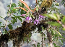
Such restrictions have undoubtedly made a significant contribution to the preservation of the region’s flora and fauna. Eastern Nepal and much of Sikkim are of great interest to the botanist and many new species are still being discovered in the vast forests and remote valleys.
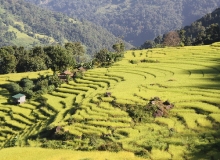
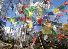
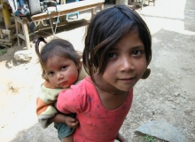
Cultures also have been preserved. Tibetan Buddhism is the most important religion in Sikkim and there are numerous monasteries dotted throughout the hills. In contrast, Hinduism is the main religion on the Nepal side of the border, where the tiny hill villages are inhabited by Rai and Limbu farmers.
Detailed Itinerary
ARRIVE KATHMANDU mid-afternoon.
1
KATHMANDU
2
FLY TO BIRATNAGAR
3
FLY TO TAPLEJUNG (SUKHETAR), (5,900ft). TREK TO TABAWA, (6,562ft).
4
TREK TO KHESEWA. (6,900ft). 5 hours.
5
TREK TO MAMANKE. 6 hours.
6
TREK TO YAMPHUDIN. (7,054 ft), 5 hours.
7
TREK TO LAMITE Jungle Camp (3 – -4hrs).
8
TREK TO TORONGTAN. (9,514 ft), 6 hours.
9
TREK TO TSERAM. (12,139 ft), 5 hours.
10
TREK TO RAMZE. (14,764ft), 6 hours.
11
TREK TO OKTANG, (16,404ft), AND RETURN TO LABSANG.
12
CROSS THE MIRGIN LA. (14,698ft), 8 hours.
13
CROSS THE SINION LA, (13,287 ft), DESCEND TO GHUNSA. 6 hours.
14
TREK TO KAMBACHEN, (13,123ft), 5 hours.
15
REST DAY
16
TREK TO LHONAK. (15,354ft), 6 hours.
17
TREK TO PANGPEMA. (16,502 ft), 4 - 5 hours.
18
REST DAY, LOCAL EXPLORATION AND SHORT WALK BACK TO LHONAK. (15,354ft), 2 hours.
19
RETURN TREK TO KAMBACHEN. (13,123ft), 4 hours.
20
TREK TO KYAPRA. (8,661ft), 7 hours.
21
TREK TO TANGEP. (5,577ft), 4 or 5 hours.
22
TREK TO SAKANTHON. (5,000ft), 4 hours.
23
TREK TO SINWA. (3,576ft), 5 hours.
24
TREK TO DOBHAN. (2,650 ft), 4 hours.
25
TREK TO TAPLEJUNG / SUKHETAR.
26
FLY TO KATHMANDU VIA BIRATNAGAR.
27
AT LEISURE IN KATHMANDU.
28
Depart Kathmandu for home!
29
Please Note: On adventure trips of this type, weather, local politics, transport or a multitude of other factors beyond our control can result in a change of itinerary. It is, however, very unlikely that the itinerary would be substantially altered; if alterations are necessary the leader will decide what is the best alternative, taking into consideration the best interests of the whole group. Where a change does occur, we do everything we can to minimize its effect, but we cannot be responsible for the results of changes or delays.
Synopsis
Trip Grading:

Length: 29 days total, 23-day trek.
Max. Altitude: 16,500 ft. / 5030m.
Begins/Ends in Kathmandu
Land Cost: $4350 (Based on 8+ participants) Full-service camping trek (includes, tents, food, guide, staff, etc.)
International Airfare: Apx. $1800 to Kathmandu (from North America)
Apr 05 - May 03, '20
Oct 04 – Nov 01, ’20
Apr 04 - May 02, '21
Oct 03 – Oct 31, ’21
Single Supplement:: $245
You can also contact Canadian Himalayan Expeditions directly for more information.
Synopsis
Trip Grading:

Length: 29 days total, 23-day trek.
Max. Altitude: 16,500 ft. / 5030m.
Begins/Ends in Kathmandu
Land Cost: $4350 (Based on 8+ participants) Full-service camping trek (includes, tents, food, guide, staff, etc.)
International Airfare: Apx. $1800 to Kathmandu (from North America)
Apr 05 - May 03, '20
Oct 04 – Nov 01, ’20
Apr 04 - May 02, '21
Oct 03 – Oct 31, ’21
Single Supplement:: $245
You can also contact Canadian Himalayan Expeditions directly for more information.
